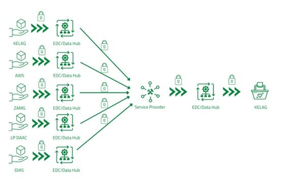
Use Case Space4Energy
Problem: A major problem in the energy sector is the high greenhouse gas emissions resulting from the heating and cooling of residential buildings and industrial processes.
Solution approach: In this project, local high-resolution earth observation data are used for thermal monitoring and exploration. By combining various geospatial data, a high-resolution land surface dataset is created, specifically for use in thermal management. The stakeholders of interest include district heating networks, policymakers, and communities served by these networks. By enabling the detection of unused temperature differences to improve heating/cooling efficiency and guidance can be provided for local policy makers* to plan countermeasures against urban heat islands.
Added value: On the one hand, this results in business value through
- Monitoring of inefficient heat transfers
- Planning of investments for system stability and efficiency.
On the other hand, this will lead to
- Mapping and utilization of areas of available waste heat for other locations with increased cooling and heating needs


